The Relief Map of Guatemala (Spanish: Mapa en Relieve de Guatemala) is a truly unique attraction located in Guatemala City, the capital of Guatemala. Imagine a giant three-dimensional map of the entire country spread out under the open sky—this is exactly what awaits you here. It is not just a map, but a true work of engineering and cartographic art, allowing you to literally "walk through" the country's diverse landscapes.
Traveler photos:
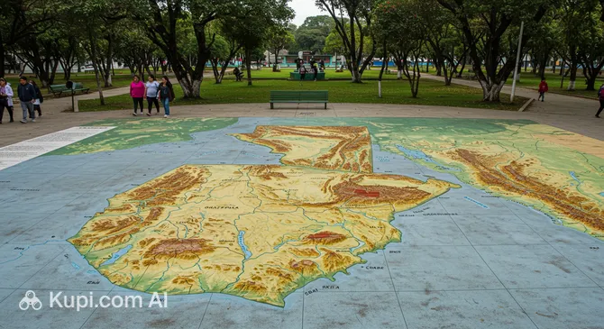
Created with striking precision at a scale of 1:10,000, this relief installation detailedly displays all the geographical features of Guatemala. Visitors can visually study the location of major cities and small towns, see the silhouettes of majestic volcanoes, trace riverbeds and lake contours, and appreciate the elevation changes across plateaus and valleys. This impressive sight offers a unique opportunity to see the entire country as a whole.
The Relief Map covers an impressive area of about 1,800 square meters and is located in Minerva Park in the northern part of Guatemala City. Due to its size, high level of detail, and unique concept, it is rightfully considered a national treasure and one of the most unusual and interesting geographical installations in the world. Visiting this attraction will be an educational and memorable experience for any traveler interested in the geography and culture of Guatemala.